

The Midwest Glacial Lakes Partnership (MGLP) is excited to release its new MGLP Conservation Planner, which provides lake data to inform communication, management, and research to benefit fish habitat and lake ecosystems. Specifically, the MGLP Conservation Planner provides data on likely suitability for fishes, land cover along the shoreline and in the lake’s watershed, and conservation recommendations to supplement existing information for each lake. Its recommended uses include provision of data to inform single-lake management, establishment of a framework for conservation strategies in each lake, identification of patterns in fish habitat due to climate and land use change, and as a supplement during potential prioritization of limited resources among lakes. Learn how to use the Conservation Planner by attending this webinar live on May 15th or afterward in the archive of MGLP Lake Conservation webinars.
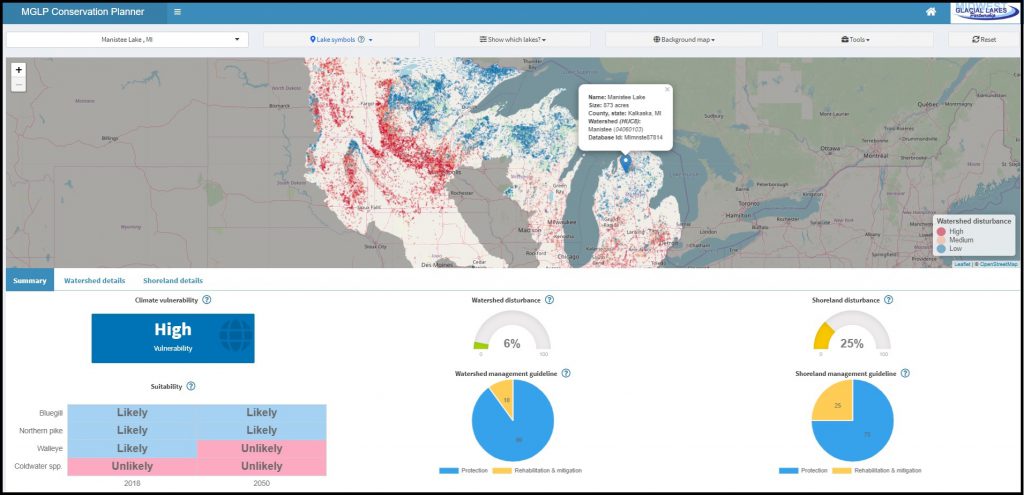
The MGLP Conservation Planner provides data on the ~40,000 inland lakes over 10 acres within the Midwest Glacial Lakes Partnership’s 8-state footprint. For fish habitat suitability data, we developed species distribution models that predict the presence or absence of a species using a suite of variables describing lake temperature, morphology, hydrology, and connectivity. These models were used to estimate whether each lake was likely to support representative warmwater (Bluegill), coolwater (Northern Pike and Walleye), and coldwater (any coldwater species including Cisco, Lake Whitefish, Lake Trout, and Burbot) fishes. These models were applied using current (2018) and future (2050) climate scenarios to assess changes in fish habitat suitability.
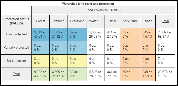
We delineated lake watersheds and assessed disturbances in the watershed using information from the 2006 National Land Cover Database. In general, urban and agricultural land cover increase sediment and nutrient inputs to lakes as a result of runoff, sewage, leaking septic systems, and other sources. We delineated each lake’s watershed and report watershed disturbance as the proportion of the watershed area with urban or agricultural land cover.
“We’re really excited, and are looking forward to using the tool to help build Wisconsin’s healthy waters program to protect lake water quality and fish habitat,” says Pamela Toshner, a Lake & Watershed Protection Specialist with the Wisconsin Department of Natural Resources.
We also delineated shorelands as the area within 100m of each lake and assessed disturbances to the shoreland using information from the 2006 National Land Cover Database. We report shoreland disturbance as the proportion of the shoreland area with urban or agricultural land cover. Shorelands provide habitat for fish and wildlife species, influence the movement of nutrients and woody debris, and affect soil erosion along the lake shore. Human development within shorelands often results in decreased aquatic vegetation and large woody habitat, hardening of the shoreline, reduction in water quality, and declines in fish and wildlife populations.
We recommend tailoring shoreland and watershed management strategies to existing land use and land cover. We distinguish between two strategies for shoreland and watershed conservation, and provide general guidance regarding the recommended distribution of effort toward protection versus rehabilitation and mitigation based on the condition of these areas summarized for each lake. This guidance is based off of a review of the literature, feedback from a focus group of stakeholders, and consensus from the MGLP Science and Data Team. The most efficient strategy is protecting land. Examples of protection include acquisition, easement, zoning, invasive species protection, and monitoring. In some cases, critical habitats or land have been degraded; rehabilitating and mitigating this degradation is often more expensive and does not provide all of the ecosystem functions that an undisturbed ecosystem would provide. Examples of rehabilitation include reforestation, creation of vegetated buffer strips, building engineered wetlands or stormwater retention ponds, bioengineered shorelands, and addition of large woody habitat. Examples of mitigation include using best practices for fish passage on road-stream crossings, erosion control measures, and minimizing sewage and runoff.
The MGLP Conservation Planner is the culmination of a ten-year effort by scientists and managers within the partnership. The Science and Data Team collected data from state, federal, and tribal partners to conduct its fish habitat analyses, and developed the Conservation Planner based on these results. The Conservation Planner was targeted at needs identified by a survey of MGLP Partners and was evaluated for iterative improvements by a dedicated focus group and over 40 committee members within the partnership. We plan to update the MGLP Conservation Planner based on user feedback and new data. Your feedback is welcome; please contact MGLP Coordinator Joe Nohner with comments or questions.
The MGLP brings together resource agencies, non-profit organizations, and other stakeholders to protect, rehabilitate, and enhance sustainable fish habitats on naturally formed (glacial) lakes of the Midwest. We foster collaborations on fish habitat science, education and outreach, and conservation. For more information, please follow us on Twitter or reach out to our coordinator, Joe Nohner. If you are not already on our newsletter email list, please SIGN UP NOW to learn about MGLP activities including our annual request for grant proposals coming in August.