


Way back in 2009, the MGLP identified the need to conduct an assessment of all ~40,000 lakes in its footprint to inform fish habitat conservation. Partners recognized the need to tailor their actions to each lake and to prioritize their actions given the limited amounts of funding and resources. Almost ten years later, following multiple iterations, countless meetings, and feedback from partners, the MGLP is finalizing the assessment and building a web viewer for partners to use it in their work.
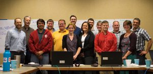
The assessment is a product of the MGLP’s Science and Data Team, who contributed their own time to bring it together. The assessment predicts the presence or absence of four species of fishes representing temperature guilds, and uses climate change and land use change information to assess threats in the shoreland surrounding the lake and in the watershed. The team took great care to ensure that these efforts were beneficial to fisheries managers, conservation organizations, and other practitioners. After repeated rounds of feedback from the MGLP Steering Committee, the team conducted a survey this March of almost 400 MGLP partners to learn about their information needs and uses for the assessment. The team developed a draft web viewer based on that feedback, and in June the team conducted a 2-day workshop in Minnesota to gather even more input on questions such as “Could you use this tool with little training or GIS experience?” and “What information could you use from such a tool to assist your fish habitat conservation efforts?” Feedback from the workshop is helping the team to tailor information to meet practitioners’ needs.
For example, the assessment and web viewer will help practitioners identify specific sets of conservation actions based on the unique set of threats facing each lake. Whether their backgrounds were in outreach and education, land acquisition, fisheries management, or habitat grant administration, participants were excited to start using the assessment and web viewer. This was summed up in one of the anonymous feedback forms by a participant who wrote, “I look forward to seeing the next version of the tool, and ultimately using it for project prioritization, education and outreach, etc.”
The Science and Data Team is now implementing recommendations from the workshop to improve the web viewer, which it plans to release in the coming months. Stay tuned!