

We are excited to announce our 2025 Lake Conservation Webinars, which start next week!
These free webinars address a diverse range of lake and fish habitat management issues such as aquatic plants, algal blooms, national lake water quality mapping, conservation planning, practices for managing farm drainage and runoff, fish habitat structures, Walleye spawning and stocking, and disproportionate monitoring relative to communities of color.
Check out our lineup below and register using the links provided. You can view the full list of webinars plus recordings of past webinars on our Lake Conservation Webinars webpage.
| Tracking lake productivity with satellites: The lake trophic state — U.S. dataset Michael Meyer March 11, 2025 at 1 PM Central Register for webinar |  |
Lakes are integrators of the watersheds in which they reside. With an emphasis on state changes and potential threats to water quality, eutrophication (i.e. greening) and dystrophication (i.e. browning) are examples of how changes to nutrient and organic matter inputs can lead to shifts in trophic state. We combined Landsat surface reflectance values with in situ true color and phosphorus data from the U.S. Environmental Protection Agency’s National Lake Assessment to build classification models of lake trophic state. From 1985 through 2020, we found that the majority of lakes greater than 10 ha in the US were consistently mixotrophic/eutrophic (~55%), while dystrophic lakes have substantially increased nationally (from ~2% to ~12%). This “brownification” trend was concentrated in the Upper Midwest and Northern Appalachian regions.
| US lakes are monitored disproportionately less in communities of color Jessica Díaz Vázquez March 18, 2025 at 1 PM Central Register for webinar |  |
Local-scale environmental justice studies of freshwaters have found that marginalized populations are more likely than others to be burdened with poor-quality waters. We analyzed racial and ethnic community composition surrounding lakes and the presence of one-time and long-term water-quality data across the conterminous US. Relative to lakes in White and non-Hispanic communities, lakes in communities of color and Hispanic communities were three times less likely to be monitored at least once. Moreover, as compared to lakes in White communities, lakes in communities of color were seven times less likely to have long-term monitoring data; similarly, as compared to lakes in non-Hispanic communities, lakes in Hispanic communities were nineteen times less likely to have long-term monitoring data. Given this evidence, assessing the current water quality of and temporal changes in lakes in communities of color and Hispanic communities is extremely difficult. To achieve equitable management outcomes for people of all racial and ethnic backgrounds, freshwater monitoring programs should expand their sampling and revise their designs.
| Restoration of freshwater fish habitat: What works and what doesn’t Steven Cooke March 25, 2025 at 1 PM Central Register for webinar |  |
Each year millions of dollars are spent on the restoration of habitat in freshwater ecosystems. Therefore, an obvious question to ask is “what works and what doesn’t” to ensure that efforts are focused on specific actions that truly benefit freshwater life and the people that depend upon healthy and productive lakes and rivers. This presentation will consider the extent to which habitat restoration initiatives are consistent with the evidence. It will also explore emerging topics such as the use of plastic materials for restoration.
| Walleye use of a wetland complex in a South Dakota glacial lake Logan Cutler April 1, 2025 at 1 PM Central Register for webinar | 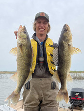 |
This research examines how walleye use wetland habitat in a South Dakota glacial lake though diet analysis, acoustic telemetry, and bioenergetics modelling. In general, walleye used wetlands as productive feeding habitats, particularly in Summer and Fall, and bioenergetics modelling indicated that walleye that used wetland habitat more often grew faster as a result. Protection, restoration, and reconnection of wetland habitat in glacial lakes is growing in importance as urban development, agriculture, and barriers to fish movement threaten fish access to these valuable resources.
| In the weeds: A closer look at interactions between fish and aquatic plants in the Upper Midwest Zach Feiner and Robert Davis April 8, 2025 at 1 PM Central Register for webinar |  |
Interactions between aquatic plants and fish are not well understood in Midwestern Lakes. Here, we will present the findings of workshops with various groups of stakeholders that sought to understand what questions and interests they have related to aquatic plants and fish. In the second part of the presentation, we will highlight the key findings of a study that sought to understand what role aquatic plants play in walleye recruitment, which was identified as a potential research question at the workshop sessions.
| The legacy phosphorus problem: Solutions for protecting inland lakes Ehsan Ghane April 15, 2025 at 1 PM Central Register for webinar |  |
Join this webinar to learn where most phosphorus comes from: is it tile drainage, fertilizer application, or the soil? Then, learn which conservation drainage practices reduce phosphorus the most. We will also discuss if nutrient management can play a role in reducing phosphorus loss.
| Walleye stocking success in the Midwestern USA Daniel Isermann and Robert Davis October 7, 2025 at 1 PM Central Register for webinar |  |
This study evaluated stocking success of Walleye in lakes and reservoirs across the Midwestern United States to inform stocking practices for state agencies. Demand for Walleye stocking may increase if climate change limits the potential for natural recruitment in lakes. Consequently, the strategic distribution of Walleye stocking may maximize fishing opportunities. Latitude and year explained relatively little variation in stocking success compared to within‐lake variation. Relative abundance of Largemouth Bass was an important indicator of Walleye stocking success for fry and fingerlings, with stocking success generally decreasing with increased bass abundance. There was an interaction between lake surface area and growing degree‐days, as large lakes (>2500 ha) seemed to be more conducive to Walleye stocking success regardless of growing degree‐days. These findings may help to inform the management and stocking allocation of Walleye and suggest that future increases in Largemouth Bass abundance and growing degree‐days could limit the effectiveness of stocking in some lakes.
| Expect the unexpected: Physical drivers of harmful algal blooms in remote systems Adam Heathcote October 14, 2025 at 1 PM Central Register for webinar |  |
Harmful algal blooms (HABs) are often linked to external nutrient inputs from anthropogenic phosphorus pollution or atmospheric nitrogen deposition. However, the increasing occurrence of blooms without these inputs has shifted attention to internal drivers. Recent research highlights internal phosphorus loading from sediments, driven by changing stratification patterns, as a key trigger. We present examples from wilderness to hypereutrophic lakes, where HABs occur or intensify due to anoximixis. Using high-frequency sensors and traditional monitoring, we compare bloom timing and intensity with factors such as hypolimnetic phosphorus accumulation, mixing frequency, and cyanotoxin production. Our findings emphasize the need to understand anoximixis as climate change alters lake stratification and accelerates oxygen depletion. These changes may lead to more toxic blooms in affected systems and trigger blooms in lakes previously thought to be resistant.
| Smart maps, stronger conservation: Targeting land protection with GIS Annie Knight, Ally Mazurek, Mitch Brinks, and Paul Radomski October 21, 2025 at 1 PM Central Register for webinar |  |
Northern Waters Land Trust (NWLT) will be presenting on their MGLP-funded project, which developed an interactive GIS mapping tool to identify and prioritize land protection projects within the watersheds of Lakes of Outstanding Biological Significance. In collaboration with a Minnesota DNR researcher, a GIS specialist, and NWLT staff, each parcel within these sensitive watersheds was systematically scored to determine conservation priority. Join this session to learn exactly what metrics were used to evaluate parcels, how the data were integrated into GIS, and how NWLT applies this tool to enhance targeted outreach. This innovative approach has led to a higher volume of landowner applications, increased the quality of land protection projects, and strengthened NWLT’s ability to secure funding for future conservation efforts. Discover how scientific methodology and strategic mapping are shaping the future of land conservation in northern Minnesota.